|
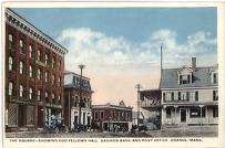
The Square-Showing Odd Fellows Hall, Savings Bank and Post Office, Orange, Mass.
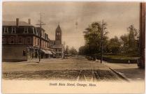
South Main Street, Orange, Mass.
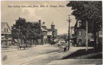
View looking down from North Main Street, Orange, Mass.
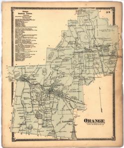
"Orange"
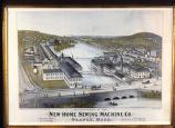
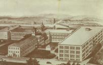
New Home Sewing Machine Company Birds-Eye View
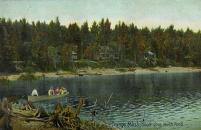
South Cove, North Pond
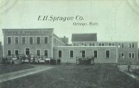
F. H. Sprague Co.
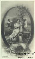
"Souvenir of Orange, Mass"
Minute Tapioca factory
|
Summary and Objective
Students will compare historic and current photographs and maps of their town. They will understand that maps and photographs can be studied to learn how a town has changed and remained the same over time.
Teaching Plan
Step 1.
Model "learning to look" using historic maps and images of Orange. Review map skills. Study the historic map of Orange, "Orange." Locate and list buildings and landmarks such as roads, schools, businesses, bodies of water, parks, and others.
Step 2.
Study historic pictures of Orange, "The Square-Showing Odd Fellows Hall, Savings Bank and Post Office, Orange, Mass.", "South Main Street, Orange, Mass.", "View looking down from North Main Street, Orange, Mass.", "New Home Sewing Machine Company Birds-Eye View", "F. H. Sprague Co.", "Minute Tapioca factory", "Souvenir of Orange, Mass" and "South Cove, North Pond". List additional buildings and landmarks that were not found on the map.
Step 3.
Provide an old map of your town and review it in small groups.
Step 4.
Provide old photographs of your town and review it in small groups.
Step 5.
Provide a current map of your town. Locate and list buildings and landmarks such as roads, schools, businesses, bodies of water, parks, and others.
Step 6.
Study recent photographs of the area and/or take a field trip into the center of town. List additional buildings and landmarks that were not found on the maps. Discuss why some things may not have been on the maps.
Step 7.
Make a Venn Diagram to show the differences and similarities found. Discuss why some buildings and landmarks were on one map, but not on the other. Discuss which buildings and landmarks are on both maps and compare what they were used for/named in the past and present. Discuss why uses and names may change/remain the same over time.
Step 8.
Think about the future of your town. Discuss what could change and remain in the years to come and why. Students could draw a map of what they think their town may look like in the future.
|


