icon for Home page
icon for Kid's Home page
icon for Digital Collection
icon for Activities
icon for Turns Exhibit
icon for In the Classroom
icon for Chronologies
icon for My Collection

Online Collection

front
(c) Pocumtuck Valley Memorial Association, Deerfield MA. All rights reserved.
Contact us for information about using this image.


label levels:

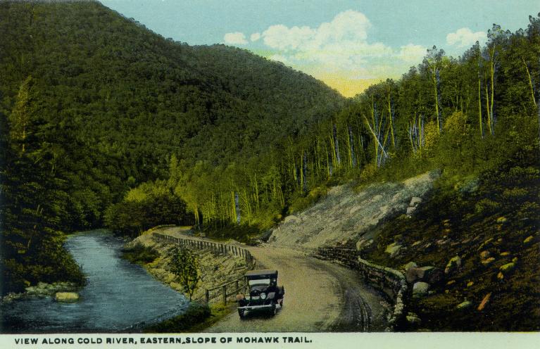
The Mohawk Trail in western Massachusetts was an improved road suitable for automobile use by the time the state legislature voted to make it a scenic route in 1914. The Trail connected the towns in the western part of the state with the Connecticut River Valley. It runs from Greenfield, in the east, to the town of North Adams, to the west. Building, grading and maintaining this 41-mile road was costly and difficult. This postcard view of a car traveling alongside the Cold River reveals how the mountainous terrain there made a retaining wall necessary.


top of page

View Along the Cold River, Eastern Slope of Mohawk Trail

creator   Curt Teich and Company, Incorporated
date   c. 1915
location   Massachusetts
process/materials   half-tone paper print
item type   Photograph/Photograph - Postcard
accession #   #1999.03.0038.16


Look Closer icon My Collection icon Detailed info icon


ecard icon Send an e-Postcard of this object


See Also...

View Along Cold River, Eastern Slope of Mohawk Trail

Mohawk Trail explanatory text

Deerfield Town Meeting


button for Side by Side Viewingbutton for Glossarybutton for Printing Helpbutton for How to Read Old Documents


Home | Online Collection | Things To Do | Turns Exhibit | Classroom | Chronologies | My Collection
About This Site | Site Index | Site Search | Feedback