

Advanced Search
| Online Collection |
|
||||||||||||||||||||||
|
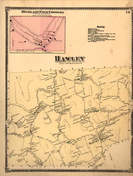
This 1871 map of the town of Hawley, Massachusetts, shows how lightly populated this small western Massachusetts town was. Rugged hills separate the homesteads and villages. Oddly though, the tallest mountain Parker Hill at 2,020 feet, the second-highest point in Massachusetts, is not depicted (it is to the east of the Mill River, on this map the area to the right of A. Gurney's and R. Sprague's homes). Hawley's major industries then consisted of the Richmond Iron Company, in the southwestern corner, and two tanneries, one in what is now West Hawley, the other on the southern border. Saw mills around the town attest to a small-scale logging industry, one that would expand in the 1890s to nearly deforest the area. The town was remote, and this inaccessibility meant that in 1871 the population was declining, with only about 800 inhabitants.
|
"Hawley"
|
| |
Home | Online Collection | Things
To Do | Turns
Exhibit | Classroom | Chronologies | My
Collection
About This Site | Site Index | Site Search | Feedback


