

Advanced Search
| Online Collection |
|
||||||||||||||||||||||
|
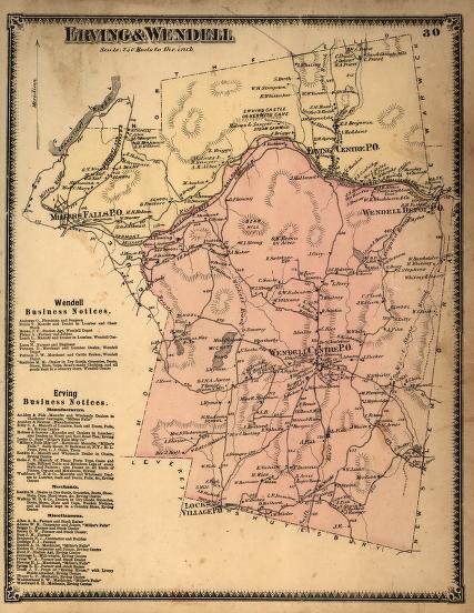
In 1871 Erving, Massachusetts, was just beginning to experience the population growth caused by the growth of Millers Falls on its western edge, where the majority of the early factories of that village were located. The remainder of the town was quite rural, with logging, wood products, and agriculture the major industries. Prominent on this map is the "Erving Castle or Hermit's Cave." There, an imposing cliff formed a natural cave that was inhabited in the late 1860s by John Smith, a Scotsman, who became something of a celebrity for his rugged lifestyle. Local fashionable ladies came to visit him on summer days. He lived there for more than twenty years before being taken into a Montague home, where he died in 1900.
|
"Erving & Wendell"
|
| |
Home | Online Collection | Things
To Do | Turns
Exhibit | Classroom | Chronologies | My
Collection
About This Site | Site Index | Site Search | Feedback


