icon for Home page
icon for Kid's Home page
icon for Digital Collection
icon for Activities
icon for Turns Exhibit
icon for In the Classroom
icon for Chronologies
icon for My Collection

Online Collection

document
(c) Pocumtuck Valley Memorial Association, Deerfield MA. All rights reserved.
Contact us for information about using this image.


label levels:

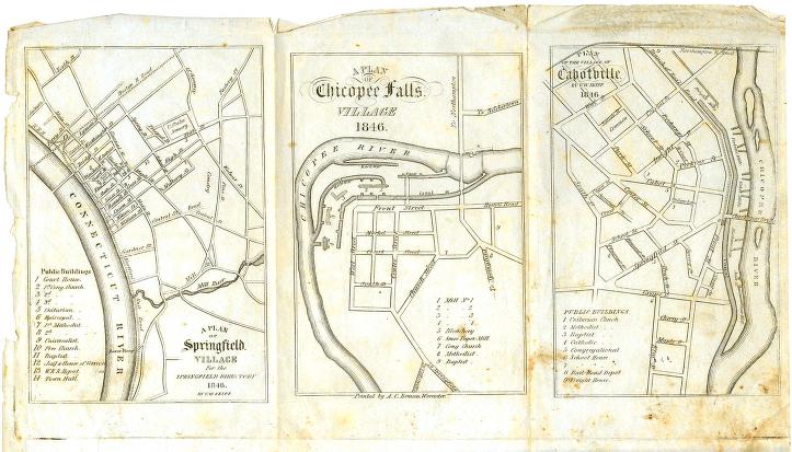
These three maps show the settled sections of Springfield, Massachusetts, in 1846. Springfield was founded in the 1630s by William Pynchon, a theologian, trader and land speculator. The sections north of the village that became Cabotville and Chicopee Falls were purchased from Native Americans in 1636 . In the mid 18th century these two villages were part of the "fifth parish" of Springfield. By the 1840s, as these maps show, they had become commercial and manufacturing centers. In 1848 the two villages merged, separated from Springfield and formed the town of Chicopee.


top of page

Plans of Springfield, Chicopee Falls and Cabotville

printer   A. C. Beman
cartographer   V. W. Skiff
date   1846
location   Worcester, Massachusetts
width   9.5"
height   5.5"
process/materials   printed paper, ink
item type   Maps/Cadastral
accession #   #L06.077


Look Closer icon My Collection icon Transcription icon Detailed info icon


ecard icon Send an e-Postcard of this object


See Also...

"Trolley Wayfinder"

"Historical Collections, being a General Collection of Interesting Facts, Traditions, Biographical Sketches, Anecdotes &c.",

"Picturesque Hampden"

Pages from the "Annals of Chicopee Street Records and Reminiscences of an Old New England Parish.."


button for Side by Side Viewingbutton for Glossarybutton for Printing Helpbutton for How to Read Old Documents


Home | Online Collection | Things To Do | Turns Exhibit | Classroom | Chronologies | My Collection
About This Site | Site Index | Site Search | Feedback