icon for Home page
icon for Kid's Home page
icon for Digital Collection
icon for Activities
icon for Turns Exhibit
icon for In the Classroom
icon for Chronologies
icon for My Collection

Online Collection

document
(c) Pocumtuck Valley Memorial Association, Deerfield MA. All rights reserved.
Contact us for information about using this image.


label levels:

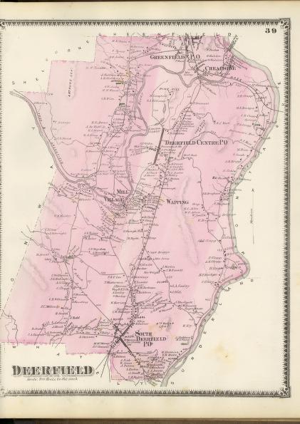
Maps serve a variety of purposes; this map records land ownership as shown by the names of individuals next to the structures they own. Maps such as this of Deerfield, Massachusetts, served as a visual town directory produced for a local audience that would have used them to locate individuals or businesses. Today these maps help us understand settlement patterns, as we can readily see the relationship between roads, natural features, and man made structures.


top of page

"Deerfield"

publisher   F. W. Beers and Company
cartographer   Frederick W. Beers (1839-1933)
date   1871
location   New York
height   15.5"
width   12.0"
process/materials   lithograph, paper, ink, watercolor
item type   Maps/Cadastral
accession #   #L00.017


Look Closer icon My Collection icon Detailed info icon


ecard icon Send an e-Postcard of this object


See Also...

"Deerfield Centre/South Deerfield"

"Greenfield (Massachusetts) Directory including Montague and Deerfield"

"Annual Report of the Treasuer, Selectmen, and School Committee, To the Inhabitants of the Town of Deerfield"


button for Side by Side Viewingbutton for Glossarybutton for Printing Helpbutton for How to Read Old Documents


Home | Online Collection | Things To Do | Turns Exhibit | Classroom | Chronologies | My Collection
About This Site | Site Index | Site Search | Feedback