

Advanced Search
| Online Collection |
|
||||||||||||||||||||||
|
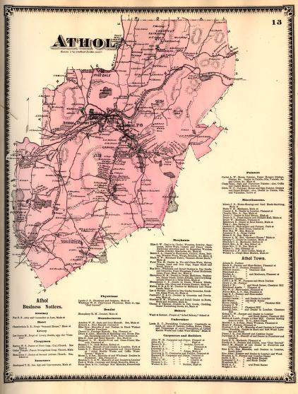
Reminded of the hills of his ancestral homeland in Scotland's Blair-Athol region, John Murray, an early proprietor of the land, named the town, Athol, Massachusetts, when it was incorporated in 1762. In the early nineteenth century, the town grew up around its water-powered mills lining the Miller's River. Industries expanded upon the arrival of the railroad in the 1840s, which enabled mill owners to cheaply send their products to larger markets. Later a railroad line connected Athol to Springfield, making Athol a regionally important tool-making center. The creation of the Quabbin reservoir in the twentieth century, however, disrupted the direct route to Springfield, and later, Route 2 bypassed the village, which further diminished the town's ability to easily transport its products. This along with the larger trend of industry becoming centralized in urban areas contributed to Athol's industrial and population decline.
|
Athol
|
| |
Home | Online Collection | Things
To Do | Turns
Exhibit | Classroom | Chronologies | My
Collection
About This Site | Site Index | Site Search | Feedback


