

Advanced Search
| Online Collection |
|
||||||||||||||||||||
|
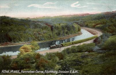
Athol, Massachusetts was called Pequoiag when colonists settled there in 1735. It is situated on the Millers River in northern Worcester County. When it was incorporated in 1762, John Murray, a prominent landowner, named it Athol after his homeland in Scotland. This postcard shows a view of the Kennebunk Curve of the Millers River with the tracks of the Fitchburg Division of the Boston & Maine Railroad following along the bank. The curve is incorrectly labeled as "Kennebec" on the card.
|
Kennebec Curve
|
| |
Home | Online Collection | Things
To Do | Turns
Exhibit | Classroom | Chronologies | My
Collection
About This Site | Site Index | Site Search | Feedback


