icon for Home page
icon for Kid's Home page
icon for Digital Collection
icon for Activities
icon for Turns Exhibit
icon for In the Classroom
icon for Chronologies
icon for My Collection

Things To Do
Dress Up | 1st Person | African American Map | Now Read This | Magic Lens | In the Round | Tool Videos | Architecture | e-Postcards | Chronologies | Turns Activities

Send an E-Postcard of:
"Warwick"

document
(c) Pocumtuck Valley Memorial Association, Deerfield MA. All rights reserved.
Contact us for information about using this image.

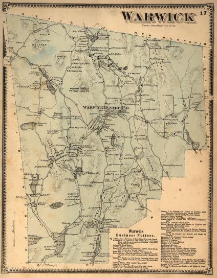
In 1871 the town of Warwick, Massachusetts, was beginning a long economic and population decline. By 1918, the industries identified on this map - lumber, staves and lath, and the boot shop - would be entirely gone, and the population of the town would have shrunk by nearly one-half. Many factors contributed to this decline, but the primary one can be seen here: there was no good transportation connection to the outside world other than the unreliable rural road network. Despite abundant water power, Warwick's industries were too far from its markets, unlike, for example, the adjacent town of Orange, whose industrial base in 1871 was beginning a rapid rise.


top of page

Share this image with a friend.
Simply enter their e-mail address below and we'll send them this image in an e-mail greeting, along with a link to see the image on our site.

To E-Mail Address *
From E-Mail Address *
From Name
Message

* = Required


button for Side by Side Viewingbutton for Glossarybutton for Printing Helpbutton for How to Read Old Documents


Home | Online Collection | Things To Do | Turns Exhibit | Classroom | Chronologies | My Collection
About This Site | Site Index | Site Search | Feedback